歌連臣
1843年來到香港作測量,畫了第一張精確的香港島地圖。此張圖是用等高綫的地圖,是英國第一張出版的等高綫地圖[2]。
| 歌連臣 Thomas Bernard Collinson | |
|---|---|
 湯馬斯.歌連臣 (Thomas Bernard Collinson) | |
| 測量師 | |
| 任期 1843年-1846年 | |
| 君主 | 維多利亞女皇 |
| 首相 | 羅伯特·皮爾爵士 |
| 前任 | ? |
| 继任 | ? |
| 个人资料 | |
| 出生 | 1821年11月18日 英格蘭達勒姆郡蓋茨黑德 |
| 逝世 | 1902年5月1日(80歲) 英格蘭倫敦伊靈區伊靈 |
| 国籍 | |
歌連臣(英語:;1821年11月18日-1902年[1]),英國測量師。初時在英國和愛爾蘭作測量。
之後其在中國沿岸畫了不少精確地圖。於1846年6月11日,乘船往紐西蘭服役。
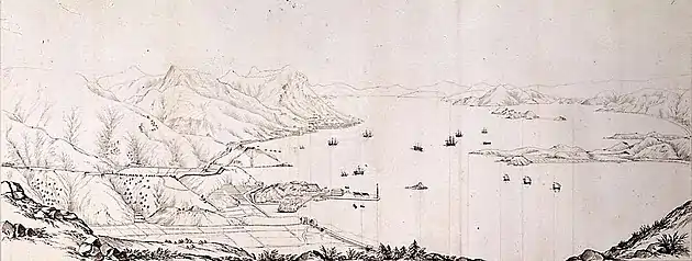
歌連臣上尉繪製的維多利亞港地形圖(1845年)
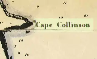
以其命名的事物
註
- , (原始内容存档于2008-10-12)
- James Hayes, (PDF), Journal of the Hong Kong Branch of the Royal Asiatic Society Vol. 24 (1984), 1984
- Yanne, Andrew; Heller, Gillis. . Hong Kong University Press. 2009. ISBN 978-9622099449.
This article is issued from Wikipedia. The text is licensed under Creative Commons - Attribution - Sharealike. Additional terms may apply for the media files.