豪斯顿街
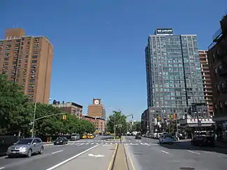
豪斯顿街(Houston Street;/ˈhaʊstən/ HOW-stən)是曼哈顿 下城的一条主要街道,东西走向,横贯整个曼哈顿岛,从东河边的羅斯福東河公園大道和东河公园,到哈得逊河边的40号码头和西邊公路。这条街构成多个街区的边界,包括北面的字母城(Alphabet City)、东村、諾豪區(NoHo)、格林尼治村和西村,南面的下东城、包厘街、諾麗塔(Nolita)和蘇豪區。曼哈顿以数字命名的街道网,是1811年规划的结果,开始于豪斯顿街以北A大道处的1街[1]。
| Houston Street | |
 | |
| 長度 | 2.0 mi(3.2 km) |
|---|---|
| 地點 | 纽约市 |
| 西端 | |
| 东端 | |
这条街的名字的发音是 “HOW-stən”,与得克萨斯州的休斯敦的发音HYOO-stən不同。这是因为这条街得名于威廉·豪斯敦律师,而休斯敦市得名于山姆·休士頓[2]。
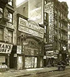
豪斯顿街 (1917)
历史
东豪斯顿街,1920年代
豪斯顿街得名于威廉·豪斯敦律师,代表乔治亚州参加了1784至1786年的大陆会议以及1787年的制宪会议。[1]
曼哈顿下城的苏豪区(Soho)因位于“豪斯敦以南”而得名,因此这条街是苏豪区的北部边界; 而豪斯顿街以北的一个较狭小的街区相应地称为諾豪區(NoHo)。
自2005年以来,这条街部分重修,2014年接近完成。[3]
交通
2010年,豪斯顿街通行M21路巴士,从罗斯福東河公園大道到华盛顿街。[4] 这条巴士线路取代了早期的电车线路,今天的M9路,从A大道到C.大道。
参考
- Peretz Square 页面存档备份,存于, New York City Department of Parks and Recreation. Accessed July 12, 2007. "North Street, then the northern boundary of settled Manhattan, was later renamed for William Houstoun, a Georgia delegate to the Continental Congress; at the time of the renaming, the more famous Sam Houston was an unknown teenager"
- . The New York Times. 2004-02-08 [2011-01-19]. (原始内容存档于2014-10-24).
- (PDF). [2018-05-18]. (原始内容存档 (PDF)于2017-02-15).
- (PDF). mta.info. Metropolitan Transportation Authority. 2015 [August 19, 2015]. (原始内容存档 (PDF)于2018-12-11).
- Knight, Sam. "What a Street! (But Do You Ever Remember Being There?)" 页面存档备份,存于 The New York Times, October 17, 2004.
- Naureckas, Jim. . New York Songlines. [2018-05-18]. (原始内容存档于2018-05-18).
- Walsh, Kevin. . Forgotten New York – Street Scenes. [2018-05-18]. (原始内容存档于2007-02-16).
This article is issued from Wikipedia. The text is licensed under Creative Commons - Attribution - Sharealike. Additional terms may apply for the media files.